Searching a STAC API for Items
Authors: Aimee Barciauskas (Development Seed)
Date: December 13, 2022
Description: This tutorial shows the generic item-level STAC search pattern using pystac-client. Use it after you have identified a collection ID and source STAC API, for example from Federated Search.
This notebook uses MAAP STAC as an example, but the same pattern works for other STAC APIs such as NASA CMR STAC or ESA MAAP STAC.
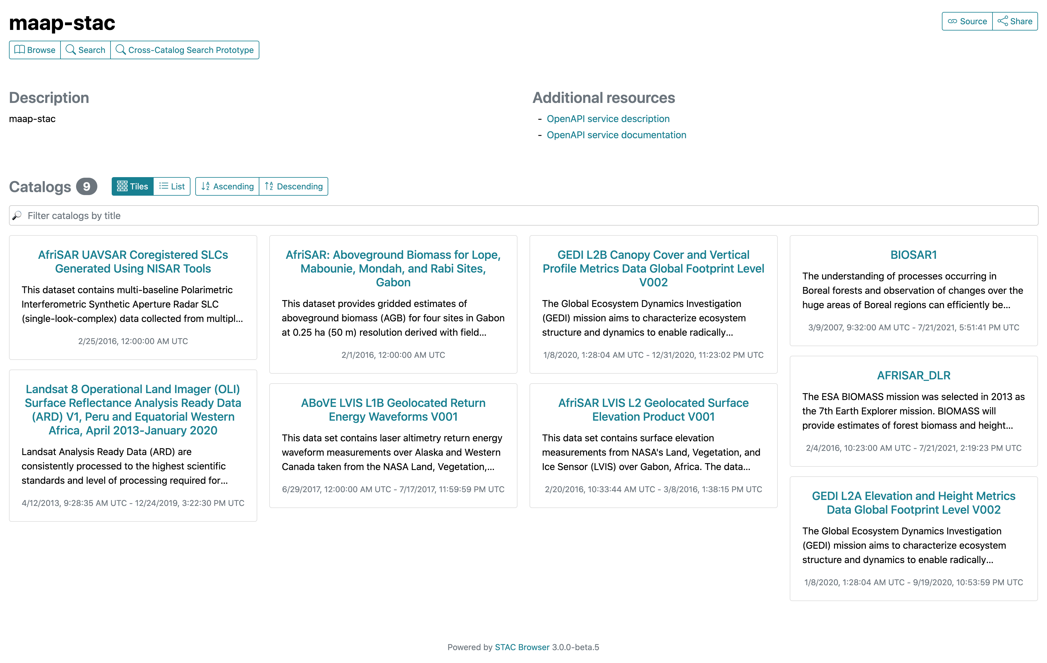
Another way to inspect a STAC API is via a STAC browser when one is available. For MAAP STAC, see the STAC browser.
About this workflow
This notebook covers item-level search in a STAC API. The recommended MAAP workflow is:
Use Federated Search to discover relevant collections across catalogs.
Copy the collection ID and source STAC API from the result you want.
Use those values here to search for items.
MAAP STAC is used below as an example endpoint, but you should replace the endpoint and collection ID with the ones that match your collection.
Additional Resources
Importing and Installing Packages
In order to run this notebook you’ll need the following packages:
[1]:
%%capture
%pip install -U pystac-client
[2]:
from pystac_client import Client
Connect to a STAC API
We first connect to the source STAC API by retrieving its landing page with Client.open. Replace URL with the source STAC API returned by Federated Search, and replace COLLECTION_ID with the collection you want to query.
[3]:
# Replace these with the source STAC API and collection ID from Federated Search
URL = "https://stac.maap-project.org/"
COLLECTION_ID = "ESACCI_Biomass_L4_AGB_V4_100m"

cat = Client.open(URL)
cat
[3]:
- type "Catalog"
- id "stac-fastapi"
- stac_version "1.0.0"
- description "STAC API for the MAAP STAC system."
links [] 33 items
0
- rel "self"
- href "https://stac.maap-project.org/"
- type "application/json"
1
- rel "root"
- href "https://stac.maap-project.org/"
- type "application/json"
- title "MAAP STAC API (dev)"
2
- rel "data"
- href "https://stac.maap-project.org/collections"
- type "application/json"
3
- rel "conformance"
- href "https://stac.maap-project.org/conformance"
- type "application/json"
- title "STAC/WFS3 conformance classes implemented by this server"
4
- rel "search"
- href "https://stac.maap-project.org/search"
- type "application/geo+json"
- title "STAC search"
- method "GET"
5
- rel "search"
- href "https://stac.maap-project.org/search"
- type "application/geo+json"
- title "STAC search"
- method "POST"
6
- rel "child"
- href "https://stac.maap-project.org/collections/Landsat8_SurfaceReflectance"
- type "application/json"
- title "Landsat 8 Operational Land Imager (OLI) Surface Reflectance Analysis Ready Data (ARD) V1, Peru and Equatorial Western Africa, April 2013-January 2020"
7
- rel "child"
- href "https://stac.maap-project.org/collections/Global_PALSAR2_PALSAR_FNF"
- type "application/json"
- title "Global 25m Resolution PALSAR-2/PALSAR Forest/Non-Forest Map"
8
- rel "child"
- href "https://stac.maap-project.org/collections/Global_Forest_Change_2000-2017"
- type "application/json"
- title "Global Forest Change 2000-2017"
9
- rel "child"
- href "https://stac.maap-project.org/collections/AFRISAR_DLR2"
- type "application/json"
- title "AFRISAR_DLR2"
10
- rel "child"
- href "https://stac.maap-project.org/collections/AfriSAR_UAVSAR_KZ"
- type "application/json"
- title "AfriSAR UAVSAR Vertical Wavenumber (KZ) Generated Using NISAR Tools"
11
- rel "child"
- href "https://stac.maap-project.org/collections/AfriSAR_UAVSAR_Ungeocoded_Covariance"
- type "application/json"
- title "AfriSAR UAVSAR Ungeocoded Covariance Matrix product Generated Using NISAR Tools"
12
- rel "child"
- href "https://stac.maap-project.org/collections/AfriSAR_UAVSAR_Normalization_Area"
- type "application/json"
- title "AfriSAR UAVSAR Normalization Area Generated Using NISAR Tools"
13
- rel "child"
- href "https://stac.maap-project.org/collections/AfriSAR_UAVSAR_Geocoded_SLC"
- type "application/json"
- title "AfriSAR UAVSAR Geocoded SLCs Generated Using NISAR Tools"
14
- rel "child"
- href "https://stac.maap-project.org/collections/AfriSAR_UAVSAR_Geocoded_Covariance"
- type "application/json"
- title "AfriSAR UAVSAR Geocoded Covariance Matrix product Generated Using NISAR Tools"
15
- rel "child"
- href "https://stac.maap-project.org/collections/GlobCover_09"
- type "application/json"
- title "GlobCover Global Land Cover Product (2009)"
16
- rel "child"
- href "https://stac.maap-project.org/collections/GlobCover_05_06"
- type "application/json"
- title "GlobCover Global Land Cover Product (2005-06)"
17
- rel "child"
- href "https://stac.maap-project.org/collections/GEDI_CalVal_Field_Data"
- type "application/json"
- title "Global Ecosystem Dynamics Investigation (GEDI) Calibration/Validation Field Survey Dataset"
18
- rel "child"
- href "https://stac.maap-project.org/collections/AfriSAR_UAVSAR_Coreg_SLC"
- type "application/json"
- title "AfriSAR UAVSAR Coregistered SLCs Generated Using NISAR Tools"
19
- rel "child"
- href "https://stac.maap-project.org/collections/GEDI_CalVal_Lidar_Data_Compressed"
- type "application/json"
- title "Global Ecosystem Dynamics Investigation (GEDI) Calibration/Validation Airborne Lidar Dataset (Compressed)"
20
- rel "child"
- href "https://stac.maap-project.org/collections/GEDI_CalVal_Lidar_Data"
- type "application/json"
- title "Global Ecosystem Dynamics Investigation (GEDI) Calibration/Validation Airborne Lidar Dataset"
21
- rel "child"
- href "https://stac.maap-project.org/collections/ABoVE_UAVSAR_PALSAR"
- type "application/json"
- title "Arctic-Boreal Vulnerability Experiment Uninhabited Aerial Vehicle Synthetic Aperture Radar Polarimetric SAR"
22
- rel "child"
- href "https://stac.maap-project.org/collections/AFRISAR_DLR"
- type "application/json"
- title "AFRISAR_DLR"
23
- rel "child"
- href "https://stac.maap-project.org/collections/BIOSAR1"
- type "application/json"
- title "BIOSAR1"
24
- rel "child"
- href "https://stac.maap-project.org/collections/icesat2-boreal"
- type "application/json"
- title "Gridded Boreal Aboveground Biomass Density c.2020 at 30m resolution"
25
- rel "child"
- href "https://stac.maap-project.org/collections/ICESat2_Boreal_AGB_tindex_average"
- type "application/json"
- title "ICESat2-Boreal Above Ground Biomass T-Index Average"
26
- rel "child"
- href "https://stac.maap-project.org/collections/NCEO_Africa_AGB_100m_2017"
- type "application/json"
- title "National Centre for Eath Oberservation (NCEO) Africa Aboveground Woody Biomass (AGB) 2017"
27
- rel "child"
- href "https://stac.maap-project.org/collections/Paraguay_Country_Pilot"
- type "application/json"
- title "Paraguay Country Pilot"
28
- rel "child"
- href "https://stac.maap-project.org/collections/ESACCI_Biomass_L4_AGB_V4_100m"
- type "application/json"
- title "ESA CCI Above-Ground Biomass Product Level 4 Version 4"
29
- rel "child"
- href "https://stac.maap-project.org/collections/NASA_JPL_global_agb_mean_2020"
- type "application/json"
- title "NASA JPL Global Above Ground Biomass Mean Prediction 2020"
30
- rel "child"
- href "https://stac.maap-project.org/collections/SRTMGL1_COD"
- type "application/json"
- title "NASA Shuttle Radar Topography Mission Global 1"
31
- rel "service-desc"
- href "https://stac.maap-project.org/api"
- type "application/vnd.oai.openapi+json;version=3.0"
- title "OpenAPI service description"
32
- rel "service-doc"
- href "https://stac.maap-project.org/api.html"
- type "text/html"
- title "OpenAPI service documentation"
stac_extensions [] 1 items
- 0 "https://raw.githubusercontent.com/radiantearth/stac-api-spec/v1.0.0-rc.1/fragments/context/json-schema/schema.json"
conformsTo [] 16 items
- 0 "http://www.opengis.net/spec/ogcapi-features-3/1.0/conf/filter"
- 1 "http://www.opengis.net/spec/ogcapi-features-3/1.0/conf/features-filter"
- 2 "https://api.stacspec.org/v1.0.0-rc.1/item-search#context"
- 3 "https://api.stacspec.org/v1.0.0-rc.1/item-search#filter"
- 4 "https://api.stacspec.org/v1.0.0-rc.1/item-search#fields"
- 5 "https://api.stacspec.org/v1.0.0-rc.1/item-search#filter:basic-cql"
- 6 "https://api.stacspec.org/v1.0.0-rc.1/ogcapi-features"
- 7 "https://api.stacspec.org/v1.0.0-rc.1/item-search#query"
- 8 "http://www.opengis.net/spec/ogcapi-features-1/1.0/conf/geojson"
- 9 "https://api.stacspec.org/v1.0.0-rc.1/item-search#filter:cql-text"
- 10 "https://api.stacspec.org/v1.0.0-rc.1/collections"
- 11 "http://www.opengis.net/spec/ogcapi-features-1/1.0/conf/oas30"
- 12 "http://www.opengis.net/spec/ogcapi-features-1/1.0/conf/core"
- 13 "https://api.stacspec.org/v1.0.0-rc.1/core"
- 14 "https://api.stacspec.org/v1.0.0-rc.1/item-search"
- 15 "https://api.stacspec.org/v1.0.0-rc.1/item-search#sort"
- title "MAAP STAC API (dev)"
Inspecting collections
If you want to inspect the collections available from the current endpoint, get_collections() will iterate through them. In many workflows you can skip this because Federated Search already gave you the collection ID you need.
[4]:
stac_collections = list(cat.get_collections())
stac_collections
[4]:
[<CollectionClient id=Landsat8_SurfaceReflectance>,
 <CollectionClient id=Global_PALSAR2_PALSAR_FNF>,
 <CollectionClient id=Global_Forest_Change_2000-2017>,
 <CollectionClient id=AFRISAR_DLR2>,
 <CollectionClient id=AfriSAR_UAVSAR_KZ>,
 <CollectionClient id=AfriSAR_UAVSAR_Ungeocoded_Covariance>,
 <CollectionClient id=AfriSAR_UAVSAR_Normalization_Area>,
 <CollectionClient id=AfriSAR_UAVSAR_Geocoded_SLC>,
 <CollectionClient id=AfriSAR_UAVSAR_Geocoded_Covariance>,
 <CollectionClient id=GlobCover_09>,
 <CollectionClient id=GlobCover_05_06>,
 <CollectionClient id=GEDI_CalVal_Field_Data>,
 <CollectionClient id=AfriSAR_UAVSAR_Coreg_SLC>,
 <CollectionClient id=GEDI_CalVal_Lidar_Data_Compressed>,
 <CollectionClient id=GEDI_CalVal_Lidar_Data>,
 <CollectionClient id=ABoVE_UAVSAR_PALSAR>,
 <CollectionClient id=AFRISAR_DLR>,
 <CollectionClient id=BIOSAR1>,
 <CollectionClient id=icesat2-boreal>,
 <CollectionClient id=ICESat2_Boreal_AGB_tindex_average>,
 <CollectionClient id=NCEO_Africa_AGB_100m_2017>,
 <CollectionClient id=Paraguay_Country_Pilot>,
 <CollectionClient id=ESACCI_Biomass_L4_AGB_V4_100m>,
 <CollectionClient id=NASA_JPL_global_agb_mean_2020>,
 <CollectionClient id=SRTMGL1_COD>]
[5]:
collection = cat.get_collection(COLLECTION_ID)
collection
[5]:
- type "Collection"
- id "Landsat8_SurfaceReflectance"
- stac_version "1.0.0"
- description "Landsat Analysis Ready Data (ARD) are consistently processed to the highest scientific standards and level of processing required for direct use in monitoring and assessing landscape change. A fundamental goal for Landsat ARD is to significantly reduce the magnitude of data processing for application scientists, who currently have to download and prepare large amounts of Landsat scene-based data for time-series investigative analysis.This Landsat ARD dataset consists of Landsat 8 Operational Land Imager (OLI) Surface Reflectance are generated using the Landsat Surface Reflectance Code (LaSRC) code. Surface reflectance (SR) is generated for the AfriSAR region of interest and consistently processed using per pixel solar zenith angle corrections and gridded to a common cartographic projection.This collection is a subset over Peru (N: -4.73978, S: -9.72818, E: -75.58157, W: -79.80472) and equatorial western Africa (N: 3.93979, S: -5.39294, E: 16.50647, W: 7.9348) for 12 April 2013 to 29 January 2020."
links [] 4 items
0
- rel "items"
- href "https://stac.maap-project.org/collections/Landsat8_SurfaceReflectance/items"
- type "application/geo+json"
1
- rel "parent"
- href "https://stac.maap-project.org/"
- type "application/json"
2
- rel "root"
- href "https://stac.maap-project.org/"
- type "application/json"
- title "MAAP STAC API (dev)"
3
- rel "self"
- href "https://stac.maap-project.org/collections/Landsat8_SurfaceReflectance"
- type "application/json"
item_assets
- title "Landsat 8 Operational Land Imager (OLI) Surface Reflectance Analysis Ready Data (ARD) V1, Peru and Equatorial Western Africa, April 2013-January 2020"
extent
spatial
bbox [] 1 items
0 [] 4 items
- 0 -79.80472
- 1 -9.72818
- 2 16.50647
- 3 3.93979
temporal
interval [] 1 items
0 [] 2 items
- 0 "2013-04-12T09:28:35.404000Z"
- 1 "2020-01-29T00:00:00Z"
- license "not-provided"
Searching STAC items
Query the /search endpoint of the STAC API to find items in your chosen collection. This method returns an ItemSearch instance which we can then turn into a list.
Read more about additional parameters to the search() method at pystac-client.readthedocs.io.
[6]:
collection_items = list(cat.search(collections=[collection.id], max_items=10).items())
collection_items
[6]:
[<Item id=LC080090662019122401T1-SC20200127151508.tar>,
 <Item id=LC080090652019122401T1-SC20200127151451.tar>,
 <Item id=LC080090642019122401T2-SC20200127163402.tar>,
 <Item id=LC080080662019121701T2-SC20200127163324.tar>,
 <Item id=LC080080652019121701T2-SC20200127163702.tar>,
 <Item id=LC080080642019121701T1-SC20200127162047.tar>,
 <Item id=LC080090662019120801T1-SC20200127162000.tar>,
 <Item id=LC080090652019120801T1-SC20200127151500.tar>,
 <Item id=LC080090642019120801T1-SC20200127163722.tar>,
 <Item id=LC080080662019120101T2-SC20200127161947.tar>]
We can also retrieve a specific item by supplying one of the IDs returned by the collection search. Then we can inspect one of its asset HREFs.
[7]:
item = collection.get_item(collection_items[0].id)
item.assets[list(item.assets.keys())[0]].href
[7]:
's3://nasa-maap-data-store/file-staging/nasa-map/Landsat8_SurfaceReflectance___1/LC080090662019122401T1-SC20200127151508.tar.gz'
Here’s a simplified example using explicit placeholders that you can swap for a different source STAC API, collection ID, and item ID.
[ ]:
# Replace these values with the source STAC API, collection ID, and item ID you want to inspect
URL = "https://stac.maap-project.org/"
COLLECTION_ID = "ESACCI_Biomass_L4_AGB_V4_100m"
ITEM_ID = "S50W080_ESACCI-BIOMASS-L4-AGB-MERGED-100m-2020-fv4.0"
ASSET_KEY = "estimates"

cat = Client.open(URL)
collection = cat.get_collection(COLLECTION_ID)
collection_items = list(cat.search(collections=[COLLECTION_ID], max_items=10).items())
item = collection.get_item(ITEM_ID)
item.assets[ASSET_KEY].href